


Distance: 1,2 km
Loop
History
Around water (canal, stream, lake, marsh, ...)
Urban
walk
Duration: 45 mn
Difficulty : Very easy
This route will allow you to discover the history and heritage of Castillon-la-Bataille.
Equipments & services
Others
- Animals accepted: yes
Your itinerary
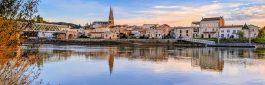
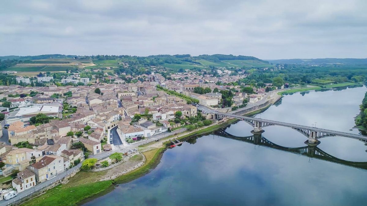
CASTILLON-THE-BATTLE
This route will allow you to discover the history and heritage of Castillon-la-Bataille.
1
The start
Leaving the Tourist Office, head straight ahead towards the 18th century Saint Symphorien church.
2
Saint-Syphorien church
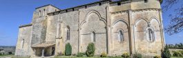
Aquitaine has few Baroque churches, including this one. This church was built at the edge of the city's fortifications. It was on the wishes of Marshal Turenne, Viscount of Castillon, that it was built thanks to his generous bequest. Inside, on the right pillar near the altar, a marble slab with a Latin inscription honors the Marshal.
3
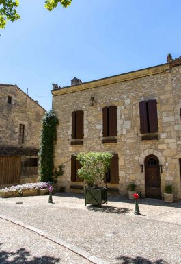
City Hall
An 18th century building, whose rotunda façade, overlooks the Dordogne. Also built on the wishes of Turenne, it was originally a hospice which, for lack of financial means, was never used as such. Its particular architecture offered better ventilation of the common rooms thanks to the numerous windows, making it possible to limit the spread of diseases.
4
Rue Vienne y Vienne
Leaving by the central alley of the gardens of the town hall, take on your right the narrow, steeply sloping alley; you will arrive in one of the oldest streets of Castillon, rue Vienne y Vienne nicknamed "Bien y Vienne". Located as an extension of a fortified gate overlooking the quays and the river. In the Middle Ages, it welcomed and channeled the arrival of travelers and goods which transited mainly by river. Visitors were "Welcome", hence its name.
5
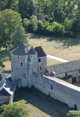
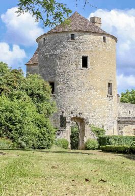
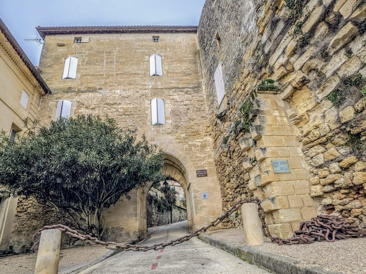
The iron gate
Continue to your right towards the gate with multiple names: river gate, postern gate, more recently nicknamed "iron gate". Originally, three gates provided access to the city, only the latter dating from the 12th/13th century (restored in 1995) has stood the test of time, earning it its nickname "iron". The large iron chain that is there dates from the 1586th century. Duke le Mayenne used it as a dam to the east in the river, to prevent Marshal Turenne from accessing the city during the siege of the Catholics in XNUMX.
6
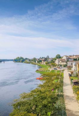
The docks
Having crossed the door, here you are on the Quays. Castillon, in the Middle Ages, was a fortified city, made up of an imposing fortified castle and various facilities (mill, well, etc.) which allowed independent living in the event of a siege. Protestant, reputed to often rebel against royal authority, Louis XIII in 1624 ordered the destruction of the city. The fortifications and the castle, already ruined by the religious wars, were demolished. The stones and rubble were used for the development of the quays and the embankment of a wide and deep ditch which was located under the current Place des Allées de la République (opposite the church).
7
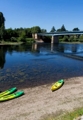
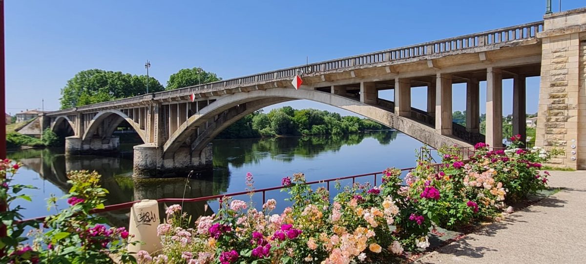
The stone bridge
On your left, spanning the Dordogne, the stone bridge. Go down to the banks of the river, turn left and pass under the arch. Inaugurated on November 26, 1950, it replaced a toll suspension bridge (the last toll bridge in the department dating from 1834). This suspension bridge was destroyed in June 1940 by the French engineering services, as was the metal bridge located downstream. Past the arch, you can see the Eiffel bridge built in 1904 to allow the crossing of heavier loads and support increasingly dense traffic at the beginning of the century. The suspension bridge was limited to 3 tons only.
8
The wash house
After you have advanced to the level of the "Rowing club" (the oldest association of the city with that of Rugby) continue to the washhouse. There were several there. They were used by the inhabitants but especially by professional laundry washers, the washerwomen. This one was equipped with a roof in 1906. It is fed by a natural source whose flow is done by a culverin (small cannon mouth) on the right side. Go up the street to the right of the wash house and take the stairs on your left - Or take the small street to the left of the wash house - Follow the route indicated on the map until you reach the cultural centre. Walk along the room to the right.
9
Esplanade Marcel Jouanno
Then you will reach the Esplanade Marcel Jouanno. This location has undergone many and multiple transformations over the centuries. In the XNUMXth century there was a convent: the Convent of the Carmelites. It was burned at the end of the XNUMXth century during the religious wars. At the end of the XNUMXth century, it was a school for boys. Today the place is occupied by a socio-cultural and administrative center. There remains of the convent on the right side, a glazed vaulted set. A breakthrough in the central part of the religious building has been created to allow access to the “main” street, rue Victor Hugo. At the left corner of the street see a historical plaque presenting the building to its origins. As you walk down the street, you reach rue Victor Hugo, nicknamed "main street" because of its concentration of shops. Facing the bank, turn right.
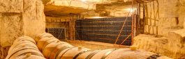
10
wine house
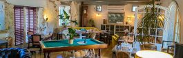
At the end of this street, turn right and see the Maison des Vins “Castillon Côtes-de-Bordeaux” on your right. You will find for sale a wide range of wines from the wine properties of the appellation as well as a shop of articles related to wine.
11
Checkin
Cross the Place des Allées de la République diagonally to the right to arrive at your starting point.